
I managed to get out again this week, it took until Tuesday though as like most of the UK the weather was pretty grim, continual heavy rain on Saturday and high winds on Monday that took a few tiles of our roof meant I didn't do much but I'd arranged with Les to go out on Tuesday.
I’ve been using Mapyx Quo mapping software for a while now and had upgraded my Garmin Gecko 301 to a Lowrance Safari with Quo Mobil XT mapping software installed but to be honest I hadn’t used it much as I really can’t be bothered to spend a lot of time on hi tech kit, especially when it comes to mapping as I know my way around the local hills anyway. Les however had purchased Quo and was using it with a Garmin mapping handheld (not sure what the model is) We wanted to try them back to back and try e-mailing routes to each other so I decided on the route, Les having done last weeks walk and planned a walk in one of the local forest parks with a bit of off trail (in the forest) and open hill work thrown in for good measure.
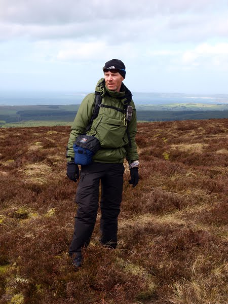
I was a bit more organised this week and had everything prepared the night before as I wanted to replace the missing roof tiles before setting off. The weather was slightly better than it had been but I wanted to try something different clothing wise so this time opted for my Montane Extreme smock, Uniqlo windproof easy trousers and this time wore a pair of Gore Bike Wear gore-tex socks with the Adidas Terrex Seamless.
Although it was bright when we set off for Ballypatrick forest there were a few heavy showers on the way which didn’t provide much of a clue as to what lay in store. By the time we were parked up the sun was shining and with the shelter of the trees I was regretting choosing Pertex/Pile and wishing I’d opted for the lighter Paramo VAL. The intention was to follow the trails for a bit before aiming for the highest point in the forest, the unpronounceable (to me anyway) Carneighaneigh from which it seemed there would be good views towards Ballycastle across the sound to Rathlin and possibly even the Mull of Kintyre to the N East and Donegal to the N West, in addition there was an cairn of some description marked on the map. From the high point the plan was to descend back into the forest using rough tracks and avoiding the actual forest drive where possible to visit a Mesolithic cairn and then on through the forest and on to the open hill for a bit before hopefully navigating to a fire break which would lead us back onto the trails and from there to the car park. Like last week we were accompanied by Fly, a one year old this week Cocker owned by Les. Fly is a cracking wee dog, full of life and character and with an endless reserve of energy.
We Hadn’t gone to far before Les was ditching his jacket while I had to make do with opening every zip on the Extreme smock but as we started up the trail towards the high point the clouds rolled in and the wind picked up so I didn’t over heat too much.

At the high point the views were much as I’d expected although visibility wasn’t the best, one thing that really stood out was the reef just off the coast near Ballycastle, I’m not sure what it’s called but looking at the map it may well be Carrickmannon, it was a seething mass of white water clearly visible even in the less than perfect light. The cairn was a bit of an anti climax looking more like a croft had been knocked down and bulldozed into a heap but we went for a closer look anyway. We had just about reached it when the shower that had been heading our direction finally arrived so we simply dropped down a firebreak for a bit of shelter. There were a few hailstones but it lasted less than 5 minutes in the end.

With the clouds speeding away we set off again descending down a rough track back into the forest where once again due to the shelter of the trees I needed to open all the vents on the smock to stay reasonably comfortable. Quite a few trees looked like they’d come down in the previous 24 hours but I spent a bit of time looking for potential hammock camping spots.

It seems though that no matter where you go fly tippers will have been there before, I can imagine Amundsun arriving at the South Pole to discover a rusty washing machine and a kid’s trike. To be truthful though the bits and pieces that were lying around were slowly but surely returning to their natural sate or being gradually buried under a blanket of pine needles.

It didn’t take too long before we reached the Mesolithic 2 Horned Cairn, hmmm looks like a pile of rocks to me but I’ll take their word for it. Ironically while the sun had been shining when we were in the forest the moment we reached an area where tree felling had been in progress and shelter was scarce the skies darkened and the rain looked to be on it’s way again.


As happened on the top of Carneighaneigh by the time we’d taken shelter and Les had swapped soft-shell for hard-shell the rain had stopped. With much of the forest part behind us and the open hill getting closer we decided to look for a suitable spot to take a lunch break. Les had a new stove (Gelert Blaze) to try out so while we waited for the water to boil and with it the prospect of a Starbucks Via we polished off a couple of Ginster’s Cornish Pasties.

Setting off again the open hill provided us with the terrain I like least although one I‘m well used to, peat banks, knee deep ankle twisting heather and knee deep peat bogs. In terrain like this it’s every man for himself but it seems that regardless of the route you choose you lose. We’d just reached the top of Crockaneel or as close to the top as it’s possible to define on what is essentially an elevated bog when Fly rose a couple of grouse, 1st a brown then a smaller black.

From there we aimed to miss the edge of the forest closest to us heading on towards a fire break that would lead us back into the forest and from there back to the track. In the end we missed it by a few hundred meters but a quick look at the map suggested that if we followed a drainage trench between the trees we intersect the fire break and it worked out just fine.

Although it can be a bit boring on the forest tracks they’re kind of welcome after stumbling about on heather so there were no complaints even though our route had us following a short section that we’d walked at the start. The rain stayed away for the final few Kilometres and the sun mostly shone until we were back at the car park.

With regard to the kit the Montane Extreme Smock was much too warm but I suspected that would be the case, the Gore Bike wear Gore-tex socks are a bit of a mixed bag, there’s no doubt that they kept my feet dry although they don’t breathe particularly well once the trail shoes are saturated, that said on balance I still prefer unlined trail shoes/gore tex socks over gore tex lined shoes as they provide more protection, lined shoes only work if you can avoid water that’s more than ankle deep and avoid wet grass unless you’re wearing gaiters which in my experience don’t really work with shoes.
What about the Lowrance Safari and Garmin GPS units and the Quo mapping software? They work, I don’t really have anything else to say to be honest, while I could happily research a tent or stove from now until Christmas, studying the various pro’s and con’s, GPS hand helds or similar techy stuff doesn’t do it for me, it’s works and really that’s all I need to know, after that it’s about as fascinating to me as an electric kettle.
On a more Sombre Note
While Ballypatrick Forest Park like most other forest parks in Northern Ireland was a popular destination for family outings during the summer and on Bank Holidays in the late 1970’s to mid 1980’s it not unreasonably became much less popular after the murder of German backpacker Inga Maria Hauser who’s body was found buried in a shallow grave within the forest. Although it happened in 1988 no one has ever been charged with the murder.
No comments:
Post a Comment